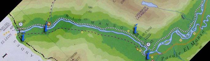
All Routes
Walk overview
General Argentinian route information
Rio Villegas to the waterfall
- Buses and Rio Villegas
- Hiking along the Rio Manso road
- Suspension bridge across the manso
- Meadows and flatlands along the Rio Manso
- Fences to avoid on the Rio Manso
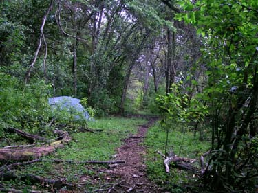
- Rio Manso - easy camping
- The waterfall marked on the map
The waterfall to the Argentine - Chilean border
- El Manso: Rafting campsite, restaurant and minimart
- Argentinian customs - Gendarmeria Nacional
- The case of the missing refugio
- Crossing the Argentina-Chile border
General Chilean route information
Paso El Leon to Torrentoso
- Chilean Carabineros, border crossing and the hamlet of El Leon
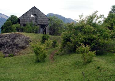
- A rangers' forest camp
- Conditions along the route
- The turn towards Torrentoso
Torrentoso to end of Lago Vidal Gormaz
- Torrentoso turning
- Camping at the south end of Lago Vidal Gormaz
- Along Lago Vidal Gormaz
- Food supplies at the north end of the lake
- Route to virgin rainforest
Lago Vidal Gormaz to La Junta
- Lakes in the rainforest
- Junction of two rivers and two paths
- El Arco refugio and natural bridge
- La Junta refugio