|
Section 2: Click on the "i"s above for information and photos of the route. |
 |
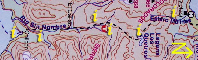
i. Laguna los Quetros to edge of Lago Rupanco
The path soon enters a long section of rainforest after leaving the El Callao thermals area. There are clear signs that the land has been farmed in the past but the forest is making excellent recovery of the land and the trees are starting to move back in. The path to Laguna Los Quetros takes around 3hrs - one long, steep up followed by a drop to a small, easily crossed, clean stream. This is the last running water before the lagoon. After a short climb back out of the gully, the path descends sharply all the way to Laguna Los Quetros.
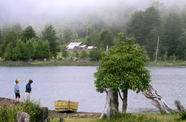
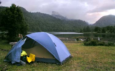
Just before arriving at the lagoon, the path comes back out into meadowland and levels out. The campsite and Lago Rupanco are signed to the left. The house visible across the laguna sells food and owns the campsite. They charge 500 pesos per person per night for their campsite with a toilet, garbage pit and picnic tables. There is no running water here and many hikers both wash in and drink from the lake, as do the cows.
There is a path that heads around the lake from here and an out and back can be done towards Rio Gaviotas. The route winds around the laguna to the far end before splitting, one continues to follow the laguna, the other breaks away to the east. Following the eastern path leads through some stunning natural forest to an isolated farmstead - the end of the path. It is possible to camp here with permission from the landowner.
Laguna los Quetros GPS coordinates
| S |
40°56.046' |
| W |
72°09.403' |