|
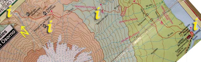
Section 1: Click on the "i"s above for information and photos of the route. |
 |
d. Edge of the plateau to Petrohue
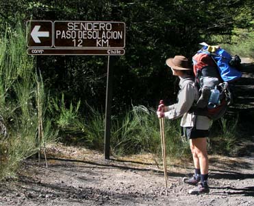
From Paso Desolacion the path descends to the lake, gaining tree cover as it goes but retaining the volcanic soil underfoot. The path splits off to the right (south) before crossing three major 'gullies' on the route - huge washouts caused by the annual snow melt crashing its way to the lake. Various routes have been created through them by walkers, cyclists and the occasional 4x4, no doubt these will continue to evolve. To reach the picnic area along the lake, follow the main route (marked by stone piles and arrows) until coming to a split offering a left hand path ( towards the lake ). This heads more directly down to the shore of Lago Todos los Santos where the pipe is just up, but easily visible, from the beach just at the south end of the small campsite / picnic area.
The lake offers cool swimming and there are plenty of great 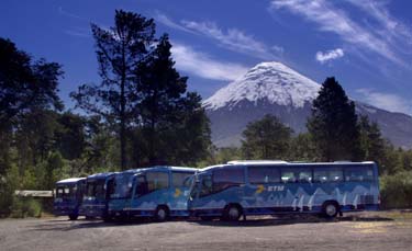 views of the volcano. A small minimart just before reaching the main body of hotel buildings has standard fare. At the road end near the hotel, there are many tourist and lake excursion companies (boats, kayaks, canoes, etc). It is fairly easy to find someone with a boat to make the journey to Chilcon. The journey is fairly expensive, costing around 35,000 pesos per boat and taking two to three hours depending on the boat and current weather conditions.
Petrohue GPS coordinates
| S |
41°08.330' |
| W |
72°24.107' |