|
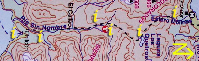
Section 2: Click on the "i"s above for information and photos of the route. |
 |
e. Chilcon / El Rincon landing to swinging bridges
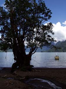
The beach at Chilcon is a beautiful sandy spot with room for camping if arriving late in the day and excellent views back across the lake in case the two hour crossing wasn't enough to take it all in. The path can be picked up at towards the western end of the beach ( the left hand end when facing inland ) or from further towards the east. Initially it climbs away from the lake sharply passing through woodland before coming out into meadowland with more views of the lake worth lingering over. The meadowland is relatively level and continues with a few undulations but no big climbs into the forest, 30-45 minutes from here is the first swing bridge of the hike, crossing over the Rio La Junta.
Almost the whole route is signed from Chilcon to Lago Rupanco, there is little chance of becoming lost and the landholders/farmers on the route are happy to help.
El Rincon/Chilcon GPS coordinates
| S |
41°03.053' |
| W |
72°09.830' |