| |
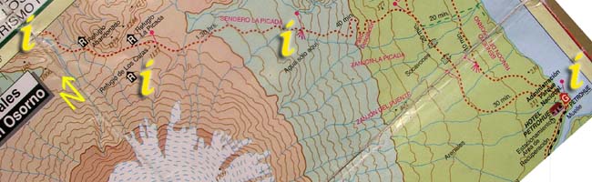
Section 1: Click on the "i"s above for information and photos of the route. |
 |
a. Bahia Cox to Refugio Picada
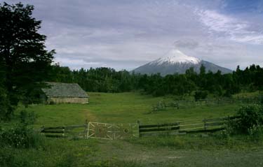
The local bus stops (when requested) at the beginning of the road towards refugio Picada and the north side of Volcan Osorno. There are no signs or other markings to show that the road goes to Volcan Osorno but the bus attendant will be able to help. From here, navigating is simple as there is only one road to follow. The views of Osorno start immediately as the road passes alongside farmland and gradually works its way up into more natural land of moss and forest. There is one major turning to bypass, it takes a bridge over the Rio Blanco. There was no supermercado in the little town at this junction in January 2004, although it may be possible to buy the produce growing in the nearby fields and gardens. Continuing straight along the road provides two main water stops - one at a stream that crosses the road (pictured on the right) and one much further up the valley. The second water point is on the left of the road where 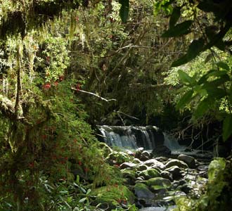 the roadside becomes moss and trees. It is possible to hear the river from the road and to follow a side driveway around 500mts to fill bottles - this is the last point of reliable water access before reaching Lago Todos los Santos. The rivers shown running down the sides of Volcan Osorno on the map are underground all year except for the spring melt. There is one point of surface water before the descent to the lake but this is difficult to locate though it is easy to hear. Carrying sufficient water, bearing in mind the potentially hot and windy weather, to make the rest of the hike without collecting more is highly recommended. In the early morning and late evenings, hummingbirds may come and check out hikers on their way to find more nectar.
Bahia Cox bus stop GPS coordinates
| S |
41°01.380' |
| W |
72°39.344' |