|
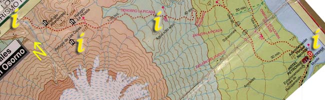
Section 1: Click on the "i"s above for information and photos of the route. |
 |
c. Volcan Osorno's derelict refugios to the edge of the plateau
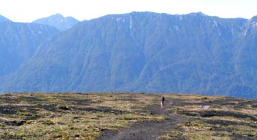
Once past the derelict Refugio La Picada the path begins to descend. The sendero is almost as bleak as the name of the pass ahead - the Paso Desolacion - and offers no shade from the sun or wind. The ground is either raw volcanic rock and dust or small scrubby plants and moss. Further into the distance the lush green of the hillsides surrounding Lago Todos los Santos offer a refreshing change of colour and some hope that life beyond the black dust and the heat still exists. In this section there is reported to be surface water, and it can be heard rushing and falling to the right ( volcano side ) of the path, but it is tricky to locate and if short of water a descent to the lakeside with its camping / picnic area complete with water taps is preferable to time spent in the sun searching.
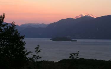
Sunset provides spectacular views of the final rays of sun hitting the high Andean mountains of the lake district long after they have left the lake.