
|
|
|
| Home Portfolio Trips Extras About Us Site Map | ||
 |
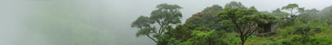
GPS 00°
80°W 3 km (1.8 miles) SE of Mariela, Ecuador [21-Jul-04] |
 |
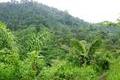
GPS 04°S
80°W 3 km (1.8 miles) E of Alamor, Ecuador [28-Jun-04] |
 |
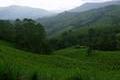
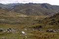
GPS 13°S
73°W 8 km (4.8 miles) SE of Yupancca, Peru [09-May-04] |
 |
GPS 14°S
70°W 2.2 km (1.3 miles) ESE of Coasa, Peru [23-Apr-04] |
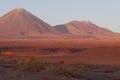 |
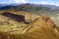
GPS 23°S
68°W 22 km (13.2 miles) WSW of San Pedro de Atacama, Chile [26-Mar-04] [incomplete] |
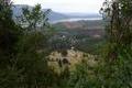 |
GPS 37°S
73°W 1 km (0.6 miles) SE of Patagua, Bio-Bio, Chile [11-Mar-04] |
 |
GPS 40°S
73°W 1.7 km (1 miles) W of La Paloma, Los Lagos, Chile [20-Feb-04] |