
All Routes
Nacional Monument Alerce Costero
Walk overview
Walk details
La Union to Mashue
- La Union buses and route information
- Trumao Junction
- Pilpilcahuin to Mashue
- Mashue: start of the Alerce Costero section of the hike
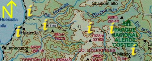
| Section 2: Click on the "i"s above for information and photos of the route. |
|
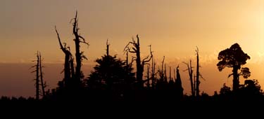
The road undulates from the monument for a few km before starting the last large climb of the walk. The treescape here is devastated, providing an eerie view over entire hillsides littered with standing dead trunks. Perhaps the most striking aspect of this scene is the knowledge that the slow growing Alerce only produce around four viable young each in their multi-thousand year lifespans.
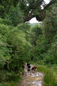
A flat area shortly after the cellphone towers ( just after the 'bienvenido to the park' sign ) offer the last camping available before the free-camp spot near the ocean. Water is periodically available from streams crossing the road and should not present much of a problem - there are cows on the hill so some care is required in choosing a source. The road is cliffed on either side, lined with trees and ferns and on a clear day offers views out to the ocean. Eventually, after about five hours of walking, the route levels out to follow alongside a river, passing through blackberry bushes, bamboo, fuchsias and ferns.