
All Routes
Nacional Monument Alerce Costero
Walk overview
Walk details
La Union to Mashue
- La Union buses and route information
- Trumao Junction
- Pilpilcahuin to Mashue
- Mashue: start of the Alerce Costero section of the hike
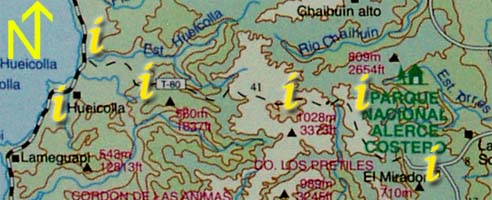
| Section 2: Click on the "i"s above for information and photos of the route. |
|
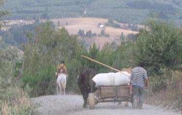
Here the road turns to dirt without rocks making for much easier walking. The clear cuts give way to natural forest lined with many ferns. The climb finally eases to a small plateau where there is a small road branching off to the right to a small stream ( in less than 100 meters ). This is the first water to be found after leaving Mashue, but the water should be treated as there are wild pigs living in the area that like to wallow in the water. There is room for a couple of tents to camp in this area.
Leaving the plateau, the road resumes climbing for another few hours to a small farm - they do not sell produce. After a bit more climbing, the road descends fairly briefly to a small river with murky water and then climbs steeply. This hill has a small waterfall with clear, good-tasting water at about the half way mark, taking about 2-3 hours to climb in total. The national monument appears shortly after the top of the hill on the left hand side.
| S | 40°13.948' |
| W | 73°21.497' |