
All Routes
Nacional Monument Alerce Costero
Walk overview
Walk details
La Union to Mashue
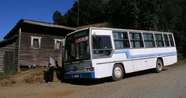
- La Union buses and route information
- Trumao Junction
- Pilpilcahuin to Mashue
- Mashue: start of the Alerce Costero section of the hike
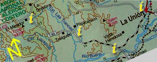
| Section 1: Click on the "i"s above for information and photos of the route. |
|
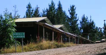
The road passes a building on the right ( this is where the bus from La Union terminates ) and then bends to the left, crossing a small stream with clear water. Shortly there is a junction signed for Hueicolla and Llancacura, take the Hueicolla fork ( and keep following signs for Hueicolla all the way to the coast ). Here an Alerce Costero sign marks the monument as being 22 km from this point. The road heads past the Carabineros post and barracks and then starts to climb through pine plantations and clear cut areas. From the start of this hill it is around a 5 hour climb to the first plateau.
| S | 40°15.586' |
| W | 73°17.961' |