 |
| Title: |
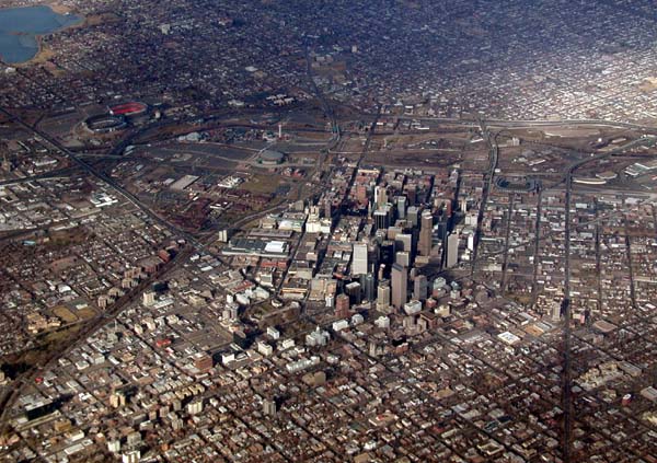
Downtown Denver from the air |
| Location: |
Denver, CO |
| Country: |
USA |
| Subject notes: |
The "Mile high city" of Denver Colorado boasts 25 million sq.ft. of office space and half a million people. |
| Photography notes: |
This photo was taken from an airplane, banking for its downwind landing leg directly over the city. The lighting was perfect, with clouds accenting the downtown area and shadowing the city behind the center in the upper left. I found a section of window without any scratches or ice crystals and by positioning my camera for this section, I was able to catch a clear view. I framed the picture to include all of the downtown and a bit of the surrounding roads to give a setting to the downtown and show the varied nature of the city. Back at my computer, the resulting picture had lots of potential, but it also had the fog of ever-present smog/haze that hangs over most major cities. Using Levels in Photoshop, I was able to eliminate the haze to show the details of the buildings below. By adjusting for a touch of red in the shadows in Color Balance, a sort of warmth appeared in the image, removing even more of the gray and making the photo look more realistic (open air) and less like it was taken through an airplane window. |
| Trip: |
Colorado in Weekend Excursions |
|
© 2004
Dana & Andy Dopleach
info@bylandwaterandair.com
Site Map


