
All Routes
This hike is possible at any time of year. The best should be the winter, May to September, but it can and does rain here all year round, the cloud rolls in and out regardless of the month.
From Cuzco, buses go to Quillabamba Mon-Sat at 8:00, 8:30 and 19:30 and Sunday at 7:00 and 17:00. The fare is around S/.15. Either take the full journey to Quillabamba (~8 hrs) or stop at Chaullay (~7 hrs), the town on the junction of the turning to Huancacalle. Quillabamba to Huanacalle takes ~4 hours ( ~3 from Chaullay ) and costs around S./8
Chaullay has one hospedaje ( S/.8 p/p ) and a couple of restaurants. Free camping is available across the river from the town ( via the bridge ) along the river bank in the dry season. To leave Chaullay it is neccesary to cross the river from the bus stop and either follow the road up or take a path that starts almost immediately after crossing the bridge on the left hand side of the road - this goes steeply up and rejoins the road at the top. Combis and buses pass here from Quillabamba. The first buildings along the road from Chaullay were abandoned and offer useful shelter in bad weather or intense sun.
Quillabamba has many more facilities than Chaullay, there are many restaurants, hostals, hospedajes and hotels along with a fairly good range of shops for this size of town. Buses leave from the main bus terminal at eccentric times of day, as travelling at night is very popular here, allowing locals to catch buses in and out of Cuzco without an overnight stay. Be prepared to set off very early ( 3:30am ) when returning from Huancacalle. There are buses and combis in the afternoons, any time after midday, but they are less reliable.
Regardless of where this section of the journey is started, the road is a bumpy journey along lumpy and wet dirt roads. Chaullay to Huancacalle is around three hours.

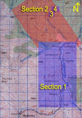
After visiting Inca Wasi, there is an alternative route back to Yupanca that passes through a different ecotypes and passes many local dwellings. From the pass head northwest to the second pass ![]() with the large wooden cross on it. From there, head due west along the tops of the ridges past two Incan miradors
with the large wooden cross on it. From there, head due west along the tops of the ridges past two Incan miradors ![]() and then cross country until reaching a pass leading down to the head of the Quebrada Challhuayoc. From here, a path runs down the northeastern side of the river. It becomes much more defined as it first ascends and then descends, offering a different experience to the endless switchbacks down to Yupanca. See the GPS page for coordinates of key locations on this alternate route.
and then cross country until reaching a pass leading down to the head of the Quebrada Challhuayoc. From here, a path runs down the northeastern side of the river. It becomes much more defined as it first ascends and then descends, offering a different experience to the endless switchbacks down to Yupanca. See the GPS page for coordinates of key locations on this alternate route.
Food availability in the Rio Vilcabamba valley is pretty poor. Sardines, eggs, bread, pasta and carbonated drinks are plentiful, but it is best to stock up on everything else in Cuzco before setting off. Fresh fruit and vegetables are in very short supply. Quillabamba offers a little more than the Rio Vilcabamba valley, but there is still very little lightweight hiking food available.
Forgotten Vilcabambaby Vincent R. Lee are extremely helpful in finding the sites of the area. It should be noted however, that the contours from the reflection pond to the cave group are not accurate, and make the group a little difficult to find until this is realized. There is a pamphlet version of the appendix with the same maps available for purchase from the Cobos's hospedaje in Huancacalle.
The only places to change money or use an ATM are in Cuzco and Quillabamba, as there are no banks anywhere in the Rio Vilcabamba valley. It was only recently that the area received its first telephone!