

|
|
|
| Home Portfolio Trips Extras About Us Site Map | ||
Department of Cusco, Peru | 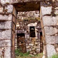 | Inca Wasi - Hike along the Rio Vilcabamba and up around the Palmayoc riverhead to the remote Incan oracle of Inca Wasi, the jewel of a collection of ruins known as Puncuyoc. |
Patagonia, Chile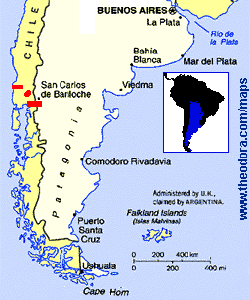
Maps courtesy of www.theodora.com/maps. Used with permission. |
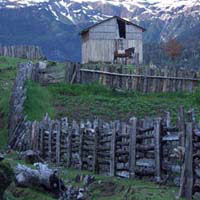 |
Rio Manso - Argentina to Chile on foot or Chile to Argentina on an infrequently used foot and horse path through mountain passes, rainforest and remote farms only accessible by trail. |
 |
Lago Todos Los Santos - Walk around the base of Volcan Ososrno, cross Lago Todo Los Santos and hike through the rainforests of Rio Sin Nombre to Lago Rupanco. | |
 |
Alerce Costero Nacional Monument - Hike over the coastal range through the Alerce Costero Nacional Monument with trees up to 4000 years old and to a remote beach on the Pacific Ocean at Hueicolla. |