
All Routes
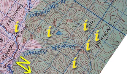
| Section 2: Click on the "i"s above for information and photos of the route. |
|
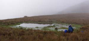

After about 35 minutes, passing both a small incan bridge and a 10 ft section of paved incan road (upper right), the path ends at a small pond / tarn (upper left) ![]() . Use this pond to mark where to leave the path, as the path heads up the hill to the east, complete with incan road at the base of it going the wrong way for Inca Wasi. From the pond, turn south and start to traverse and descend through the grass, the photo in the lower left shows the view to the south-east with a ridge
. Use this pond to mark where to leave the path, as the path heads up the hill to the east, complete with incan road at the base of it going the wrong way for Inca Wasi. From the pond, turn south and start to traverse and descend through the grass, the photo in the lower left shows the view to the south-east with a ridge 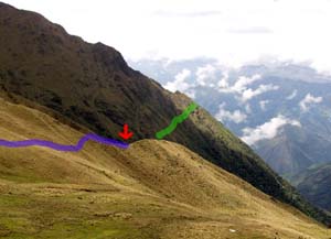 running along the eastern side of the valley. Base camp lies over this ridge and down. Cow and horse paths come and go from here down to the camp but the route is pretty straight forward. If there has been heavy rain recently, there is a route along the top of the ridge that runs down to base camp, otherwise it is just as easy to walk down the center of the smaller valley to the camp with two spots on either side of a creek. From the pond to base camp is a half hour's walk.
